

-
Via Belgica in Baesweiler
-
-

As if drawn with a ruler, the Via Belgica, the long-distance road from Cologne to the Atlantic coast, ran in a straight line from Colonia Claudia Ara Agrippinensium, the capital of the province of Lower Germania, to the west. Over long distances between Cologne and Jülich, modern roads and paths still run exactly along the route of the ancient state road. West of Jülich, however, it lost its importance in post-Roman times, as the transport link to Aachen became more important. The Via Belgica was abandoned and gave way to agricultural land.
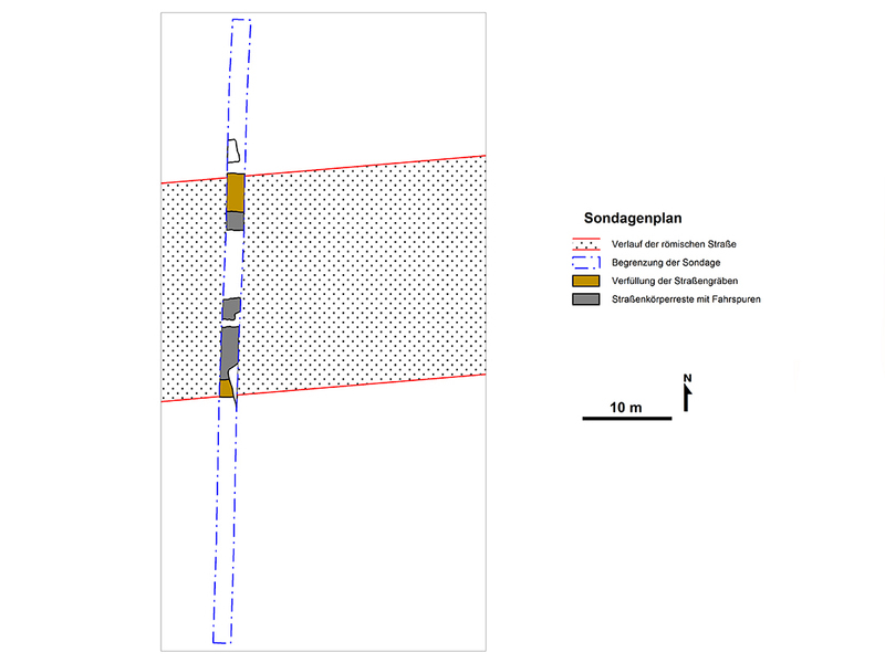
Targeted archaeological investigations have made it possible to trace the sections of the ancient long-distance road that are hidden in the farmland. In addition to the evaluation of aerial photographs and laser scans, the methods used include geophysical measurements, systematic field surveys and the creation of test pits.
The road, flanked by ditches on both sides, was almost 25 metres wide from ditch centre to ditch centre. The actual road surface, covered with gravel, varied in width from just under five metres when the road was built in the early 1st century to seven metres in the final phase of construction. The ditches served for drainage, but they also marked the boundary of the state-owned road area. Between the road embankment and the ditches were unpaved tracks filled with sand, known as summer roads. Archaeological excavations carried out on site clearly revealed the road ditches and the tracks of Roman carts dug into the ground.
The ancient route is marked in the asphalt of today's "Zum Carl-Alexander-Park" road.