

-
Via Agrippa in the Olbrück Forest
-
-
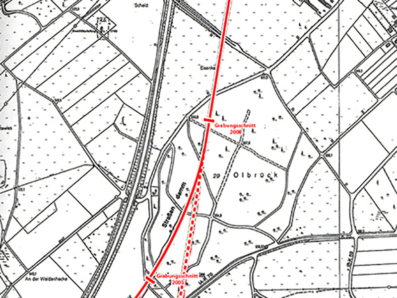
Via Agrippa runs in a straight line from Nettersheim to the Olbrück Forest – almost exactly north-south. Shortly before the forest, it curves slightly to the south-west and turns onto what is now the B51. This was not always the case: there is evidence that there was an older route during the Roman Empire. This did not bend, but continued straight on to Jünkerath. It is believed that the new route was built to accommodate the increasing transport of goods via a more convenient road.
The road foundation (substructure) of the newer route in the forest is still well preserved today and marked with pegs. The route was also clearly visible on the field south of the Olbrück Forest, due to the highly ploughed pebbles and limestone rubble of the former substructure. Today, however, it is covered by a meadow and bordered by trees across its entire width.
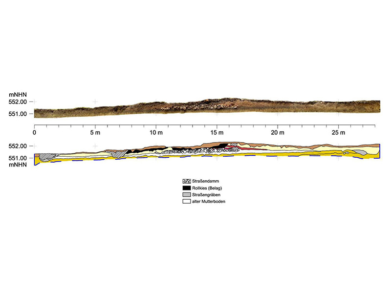
The typical structure of a rural Roman road can be seen in the south of the Olbrück Forest. Under a protective roof, there is a cut into the ground, a so-called sondage cut, on which the profile of the route can be seen. The Romans laid a six-metre-wide packing layer of limestone rubble directly on top of the existing topsoil. On top of this, they applied a 20-centimetre-thick, compacted mixture of gravel and sand. The actual roadway consisted of a wear layer of gravel that was renewed repeatedly.
In a test cut on the north side of the Olbrück Forest, the route was recorded in its full width of 25 metres. On both sides of the road embankment, the ten-metre-wide summer paths, which were intended for pedestrians, horses and cattle during the dry season and the two road ditches were uncovered.