

-
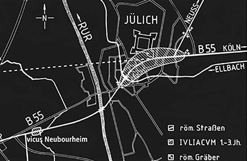
Vicus Neubourheim
-
-

A Roman settlement once stood on this site. Archaeologists discovered evidence of this as early as the 1960s, when a field survey revealed a Roman ruin measuring approximately 250 x 80 metres. Later aerial photographs indicated a 4.5-hectare roadside settlement (vicus).
A straight strip between six and twelve metres wide runs through the site, standing out clearly from its surroundings: the former road. To the right and left of it, several light-coloured strips branch off at right angles. Like the vicus Iuliacum on the right bank of the river Rur, the settlement served as a staging post at a point where travellers were forced to stop when the Rur was impassable due to flooding. In 2003, archaeologists measured the magnetic field in this area. This revealed clear irregularities on both sides of the road, indicating the presence of building structures.
The settlement area of a vicus was usually divided into long, rectangular plots that were laid out at right angles to the road. The development within the plots was predetermined: on both sides of the road stood elongated houses with their gables facing the road. Narrow gravel paths or so-called eaves alleys often ran between the houses, allowing sewage to drain away. However, the houses often shared walls. The areas behind the plots were used by the inhabitants of the settlement as gardens or commercial workshops.