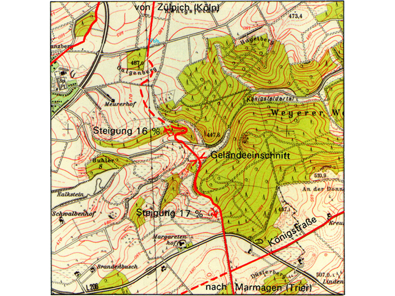
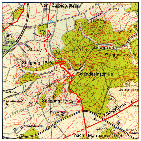
A little further south, it branches off into a western route towards Marmagen and an eastern route towards Görresburg and Nettersheim. After about two kilometres, the eastern route leads into the Königsfelder Valley with its steep ascents and descents. This was a challenge for the Roman road builders, as the road could no longer run straight here.
On the north side of the Königsfelder Valley, a sunken path can be seen at the steepest point, leading downhill in a wide arc. Archaeologists have discovered a track in a rocky ridge which, judging by its width, could be Roman. Almost parallel to the relatively flat route downhill, there was a more direct route uphill with a gradient of up to 16 per cent.
In the valley, marshy terrain and the foothills of another rocky ridge made the route more difficult. It is interesting to note that the road builders did not route the road around the rocky ridge, but removed the obstacle. The resulting gap is still visible today in a small remnant of the rocky ridge downhill to the east. Farmers may have widened it in more recent times.